Official Kenya map to be gazetted on Monday
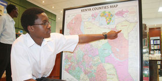
PHOTO | FILE A map with county boundaries on August 6, 2010.
What you need to know:
- The State has warned hawkers against selling fake maps, saying stern action will be taken
If you want a map of Kenya for your office or home, you will have to buy it from the Lands ministry.
The official map with the 47 counties and their boundaries will be gazetted on Monday.
This follows reports that individuals have been publishing and selling fake maps. Most of the fake maps have boundary errors in the northern and western regions and thus the need to gazette the official map which will be purchased from the Ministry of Lands by all who need it.


The State has also warned hawkers against selling fake maps, saying stern action will be taken. Many Kenyans are also being duped on boundaries and land matters by quack surveyors who have come up with fake charts.
A top security meeting was held on Friday last week between the Security and Lands ministries officials to discuss, among others, a law to protect the map of Kenya.
Section 5(2) of the Constitution says: “These (lands) principles shall be implemented through a national land policy developed and reviewed regularly by the national government and through legislation.”
The meeting, chaired by Head of Civil service, Francis Kimemia, resolved to have the new official map gazetted and sold by the Lands ministry.
“Land and boundary issues are very sensitive, they are always a cause of conflict, and that is why there is need to address the issue immediately,” Mr Kimemia said, adding: “This is our sovereignty, people should not purport to sell a map that hasn’t come from the Ministry of Lands. That is why we had an issue with Migingo (island on Lake Victoria claimed by Uganda).”