EU-backed plan inches closer to one-stop farming data hub
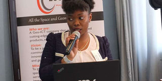
LocateIT geomatics lead Vivianne Meta speaks at the workshop at Radisson Blu, Nairobi, on September 26, 2019. PHOTO | SIMON LIBAFU | NATION MEDIA GROUP

What you need to know:
- The agricultural sector is one of the beneficiaries of innovations that seek to address production, climate resilience, pests, diseases and yields.
- The four-year project would be implemented in Tunisia, Niger, Ghana, Rwanda, Ethiopia, Mozambique, South Africa and Kenya.
The advent of information, communication technologies have seen the rise of innovations – mostly mobile phone applications – touted as the panacea of social and economic problems that Africa face.
The agricultural sector is one of the beneficiaries of innovations that seek to address production, climate resilience, pests, diseases and yields.
However, most of the solutions have come a cropper as the food insecurity persists and the adverse effects of climate change, such as floods and drought, take a toll on the continent.


EMERGING TECHNOLOGIES
To address the disconnect between emerging technologies and end-user adoption, a European Union Horizon 2020-funded project Enhancing Food Security and Agricultural Systems in Africa using Remote Sensing (AfriCultuReS) seeks to develop an information platform based on earth observation data to boost farming and decision-making in the sector.
"Creation of these apps based on earth observation is relatively recent. There has been a real spike in these kinds of applications over the last decade or so. What has been around for a bit longer is the use of ICTs to achieve development objectives. So there is a huge research literature on the use of ICT for development,” he said.
"Unfortunately what that literature shows is that a lot of this ICT for development projects don't work. There are a lot of failed projects that did not achieve objectives and ambitions they set out to achieve," Rose Pritchard of UK-based University of Sheffield, the lead partner in user requirements assessment for the project, told participants of a workshop on the project in Nairobi two weeks ago.”
MISTAKES
What's great, she added, is that “we can learn from that literature in terms of developing applications based on earth observation. We can avoid making the same mistakes."
The available data, said Ms Pritchard, has led to the development of principles for digital development and set up best practice guidelines in satellite and earth observation.
LocateIT Ltd, a space and geomatics company based in Nairobi, the local partner for the four-year project led by Spain-based company GMV, organised the second user requirements workshop in Nairobi two weeks ago, which brought together earth observation and space experts, partners, downstream users as well as end-users to chart the way forward for the development of an effective geo-based information system for the agricultural sector.
The four-year project would be implemented in Tunisia, Niger, Ghana, Rwanda, Ethiopia, Mozambique, South Africa and Kenya.
"The project has engaged a large number of African institutions with a common goal of achieving food security in sub-Saharan Africa through the use of technology," said Juan Suárez Beltrán of GMV.
SATELLITES
He decried the dearth in local knowledge in implementing an array of value-added data from different sources such as the satellites, adding that the company and its local partners have been conducting workshops across Africa to follow up on the first phase of the project.
Director of Crop Development and Agriculture Research at the Ministry of Agriculture Oscar Magenya, who spoke on behalf of PS Hamadi Boga, said the government is keen on new technologies in its efforts to boost food security.
‘'Here is where we need all the partners who can contribute to the development of comprehensive mechanisms for institutional capacities and knowledge platforms.
"Threats to food security will continue and particularly in the face of climate change, scenarios such as droughts, frequent floods, diseases and pests such as fall armyworm and maize lethal necrosis disease will increase,” said Prof Boga in a speech Dr Magenya read on behalf of the PS.
"All around the world, there are many instances where research has transformed agriculture. Systems based on precision agriculture and prescriptive planting have observed more than 50 percent increase in yields over very short periods."
TARGETING FARMERS
Nairobi-based LocateIT is building an agricultural knowledge and information systems targeting farmers, policymakers and service providers in the sector based on the data collated from the project.
"What we are trying to build here is based on what is coming out of the AfriCulTures portal focusing on County Agricultural Management Information System (Camis) because agriculture in Kenya is a devolved function. You cannot ignore the fact that counties need to be involved in this kind of development," said LocateIT’s geomatics lead, Vivianne Meta.
The new information system, she said would help farmers to address their day-to-day challenges and make informed decisions that would help them boost yields.
DISSEMINATE INFORMATION
"Camis will be able to integrate all the data sets from the platforms to disseminate information that is relevant to a farmer in ways that are simplified, accessible and in formats that are most relevant to them," said Ms Meta.
"This platform will help predict upcoming threats due to climate change and sustainable adaptation in crop and livestock systems for the rangelands as well as support disaster preparedness."
The State Department for Crop Development and Agriculture Research, said Prof Boga, is developing a centralised digitised data, information and knowledge portal where agricultural stakeholders can have access to production information on food and nutrition security.