First GIS laboratory system launched in Baringo
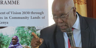
European Union Country Representative David Mwangi addressing the public at the Kenya School of Government in Kabarnet during a launch of Geographical Information System laboratory system for Baringo County on May 14, 2019. PHOTO | KNA

What you need to know:
- Other counties to benefit from the GIS laboratories are Nandi, Vihiga, Laikipia, Samburu, West Pokot, Lamu and Tana River.
- FAO Country Representative Gabriel Rugalema said the system will help the county in monitoring human activities at border points and planning on development.
Baringo County has become the first among eight selected counties in Kenya to benefit from Geographical Information System (GIS) laboratory established by Food and Agricultural Organization (FAO).
The GIS laboratory system funded by European Union (EU) to the tune of Sh5 million, targets the marginalised communities in order to help them in collection of data digitally and improve on the development of the county.
Other counties to benefit from the GIS laboratories are Nandi, Vihiga, Laikipia, Samburu, West Pokot, Lamu and Tana River.


NATURAL RESOURCES
FAO Country Representative Gabriel Rugalema said the system will help the county in monitoring human activities at border points and planning on development.
Dr Rugalema noted that the GIS system will help in getting information on the varieties of natural resources in the benefiting counties and the social facilities available adding that it will also help in management of human resources.
“The GIS system which was developed under the Ministry of Lands will be manned by a team of selected committees from the targeted eight counties,” he added.
He made the remarks Tuesday at Kenya School of Government Baringo campus in Kabarnet during launch of the GIS system in the county.
Dr Rugalema noted that the selected GIS committees from each of the beneficiary counties will be tasked to ensure that the project become successful and meet its set goals that include reduction of inter community conflicts resulting from matters like border disputes.
European Union Representative David Mwangi elaborated that the GIS laboratory system will help local and foreign investors to conveniently access land information.
Baringo Executive for Lands Elijah Kipkoros thanked FAO for considering Baringo in the GIS project saying that the system will help them collect, process and analyse data in digital form.
Baringo County commissioner Henry Wafula promised to work together with the county administration in ensuring that the planned targets are attained.
He said he was hopeful that the GIS laboratory system will bring a solution to incidences of cattle rustling and intercommunity conflicts, witnessed in border points between Baringo county and her neighbouring counties like Turkana and Samburu.