Revealed: 9 counties host over 30pc of Kenya’s population
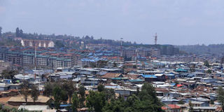
High-rise buildings are pictured next to Kibera slum in Nairobi on October 17, 2018. PHOTO | JEFF ANGOTE | NATION MEDIA GROUP

What you need to know:
- The population densities are based on the Kenya National Bureau of Statistics projections, which puts the overall population at 47 million.
- Close to 7,000 people share a square kilometre in Nairobi followed by Mombasa where 5,600 have to put up in the same size of space.
- The report shows that 16 counties have very sparse population densities, far below the national average of 81 per square kilometre.
- In August, Kenya is expected to conduct a Census billed as the biggest in the country’s history in terms of budget and staff.
Nine counties host more than 30 per cent of Kenya’s population, making them the most congested places to live in.
The nine include Nairobi, Mombasa, Vihiga and Kisii in the top four, with more than 1,000 people living in every square kilometre.
CONGESTED AREAS


Close to 7,000 people share a square kilometre in Nairobi followed by Mombasa where 5,600 have to put up in the same size of space.
Vihiga, which has an estimated population of 637,877, hosts 1,202 people for every square kilometre.
Kisii comes fourth with its 1,375,973 residents being accommodated at a rate of 1,044 people per square kilometre, according to official data released recently.
Kakamega, which borders Vihiga, almost triples its population at 1,908,309. However, it has a better population density with 625 people for every square kilometre.
Kakamega is, however, almost six times larger than Vihiga, occupying 3,051.2 kilometre square of land compared to Vihiga’s 530.9 square kilometres.
Kiambu, which neighbours Nairobi city, has a relatively high population density, with 749 people sharing a square kilometre, a figure not far from Nyamira’s 794. However, the latter’s population is lower at 714,398.
Busia has 754 people sharing the same size of space.
In Kisumu county, 555 residents occupy a square kilometre of land.
SPARSE DENSITIES
The report shows that 16 counties have very sparse population densities, far below the national average of 81 per square kilometre.
Leading the pack of the least congested counties is Marsabit, which coincidentally is the largest in terms of land size.
Only four people live in every square kilometre of Marsabit’s 70,961.2 square kilometres of land.
Isiolo, which has a relatively smaller land size, has six people for every square kilometer of land followed by Tana River (eight), Turkana and Wajir (12) and Garissa where 14 people share a square kilometre.
The population densities are based on the Kenya National Bureau of Statistics projections, which puts the overall population at 47 million.
CENSUS
In August, Kenya is expected to conduct a Census billed as the biggest in the country’s history in terms of budget and staff.
It is expected to cost Sh18.5 billion and employ more than 200,000 people.
The Census data guide planning and resource-allocation policies, a perennial source of political disputes over perceived lopsidedness.
Already, leaders from the arid and semi-arid areas have raised concerns over the way the 2019 Census will be conducted.
Both the 1999 and the 2009 results had flaws, raising suspicion on how the population numbers were arrived at.
In 2009, population numbers in Mandera, Wajir and Garissa counties of the vast former North Eastern province, as well as Turkana county in the Rift Valley, were said to have been doctored to make them higher in a possible collusion between local leaders and Census enumerators.
Planning minister Wycliffe Oparanya, who is now the Kakamega governor, told Parliament in 2012 that the Census results were overstated by 885,000 people, with most of the errors detected in the former North Eastern province.