Governors beware: There’s more to boundary reviews

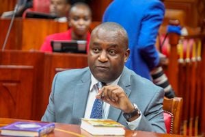
Nandi Governor Stephen Sang. Mr Sang claimed parts of Muhoroni Constituency immediately after settling into his office. PHOTO | FILE | NATION MEDIA GROUP
What you need to know:
- Nairobi, being the capital city, was accused, rightly, of amassing all the national wealth at the expense of the other regions.
- Delimitation of Kenya’s administrative boundaries has always been a matter of gerrymandering.
When Kenyans embarked on the process of making a new constitution in earnest in 1997, little did they know the governing document would one day be used by manipulative politicians to set them against one another.
They demanded, almost in unison, that there be a devolved as opposed to a centralised system of government.
After experimenting with varied forms of decentralisation, including the District Focus for Rural Development and the Constituency Development Fund, it was time to not only devolve resources but also the power to make decisions over their management and use for equitable sharing of national and local resources.
Devolution also aims to promote democratic and accountable exercise of power, and foster national unity by recognising diversity.
MARGINALISATION
Indeed, Section 30 (3) of the County Government Act provides for the functions of the governor as to, among other things, promote unity, cohesion, democracy, good governance and peace and order in their respective counties.
The First Schedule of the Constitution lists the 47 counties into which the territory of Kenya is divided pursuant to Article 6 (1) of the supreme law.
For the more than 40 years from independence to 2004 when the counties were being formed, the six coastal regions had borne the brunt of marginalisation.
Nairobi, being the capital city, was accused, rightly, of amassing all the national wealth at the expense of the other regions.
So it was time to put the biblical scripture, "The first shall be last and the last shall be the first", into practice. That is how Nairobi became county number 47 and Mombasa 01.
COLONIAL BOUNDARIES
But now, Taita-Taveta Governor Granton Samboja is at war with his Kwale and Makueni counterparts over the control of two urban centres — Mackinnon Road and Mtito-Andei respectively.
Governor Samboja claims the two fast-growing towns, situated strategically along the Nairobi-Mombasa highway, were illegally grabbed from Taita-Taveta County by the two neighbouring counties and must be reclaimed for the benefit of the people of Taita- Taveta.
Earlier, it was the turn of Nandi Governor Stephen Sang to flex his muscles with Kisumu Governor Anyang’ Nyong’o when Mr Sang claimed parts of Muhoroni Constituency immediately after settling into his office.
As a matter of fact, Governor Sang at one point threatened to invoke colonial boundaries to prove that some parts of Kisumu County had indeed been part of his county.
Governor Sang and his county government had conveniently forgotten that they had gone to court to demand compensation and other forms of reparations from the British government for injustices inflicted upon locals by the colonial government.
His Kericho counterpart, Prof Paul Chepkwony, was not left behind either. He had also staked claim to parts of Koru and the neighbouring Got Alila.
GERRYMANDERING
Vihiga County, one of the smallest of the 47 counties, only bigger than Lamu, also once claimed parts of Maseno township under the leadership of its first governor, Moses Akaranga.
Delimitation of Kenya’s administrative boundaries has always been a matter of gerrymandering.
The World Book Dictionary defines gerrymandering as “to arrange the political divisions of a city, state or country in a manner that gives one political party advantage in elections”.
With the discovery that neighbouring towns and resources could be a source of extra income for their counties, I will not be surprised if some counties decide, at some point, to have a physical fence between their common borders.
But the process of altering county boundaries is not as easy as some of the county bosses seem to think.
Article 188 of the Constitution provides that the boundary of a county may be altered only by a resolution recommended by a commission set up solely for that purpose by Parliament; and passed by two-thirds of the National Assembly and the Senate, with the support of at least two-thirds of all the county delegations.
Churchill is the Presiding Convenor of the Civil Society Reference Group, [email protected]


