Konza dispute political, says Ngilu
What you need to know:
- Mrs Ngilu defended her previous pronouncement that the site of the proposed technology hub was in Machakos, but agreed that the map was misleading as it did not conform to the Act, which describes it to be in Makueni.
- The Cabinet Secretary said the map from her ministry was drawn based on a survey in which local people played a leading role. She said it was not the responsibility of the ministry to determine boundaries.
- The Senate recommended that the controversial map that depicts the area to be in Machakos County be changed.
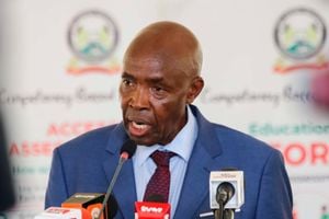
Lands Cabinet Secretary Charity Ngilu has blamed political wars for the stalemate in resolving the Konza Techno City boundary dispute between Makueni and Machakos counties.
Mrs Ngilu, who appeared before the Senate Committee on Land and Natural Resources on Tuesday, said a solution to the problem required political will from the leadership of the two counties.
The matter was taken to the Senate by Makueni Senator Mutula Kilonzo Jr, who sought a clarification on the exact location of the technocity, saying the map provided by the ministry was misleading.
Giving a brief to the committee in the presence of electoral commission chairman Isaack Hassan, Mr Kilonzo said the governors of Machakos, Makueni and Kitui counties had concurred that Konza was in Makueni County.
MAP IS MISLEADING
“We have a memorandum signed by the three governors confirming this but the problem now comes because the map says otherwise, hence creating the confusion.
“We demand to know from the ministry why the map is going against the 1992 Act,” he said.
Mrs Ngilu defended her previous pronouncement that the site of the proposed technology hub was in Machakos, but agreed that the map was misleading as it did not conform to the Act, which describes it to be in Makueni.
The Districts and Provinces Act of 1992 describes the boundary between Makueni and Machakos districts. The same was adopted in the Constitution as the boundary between the two counties.
The Cabinet Secretary said the map from her ministry was drawn based on a survey in which local people played a leading role. She said it was not the responsibility of the ministry to determine boundaries.
The Senate recommended that the controversial map that depicts the area to be in Machakos County be changed.
Mrs Ngilu agreed to a meeting planned for next week between representatives of the committee, the ministry’s technical staff and officials from the Independent Electoral and Boundaries Commission to draw it afresh.
“This boundary conflict between the two counties should now provide the framework for addressing similar cases elsewhere,” said Senator Lenny Kivuti, chairman of the committee.


